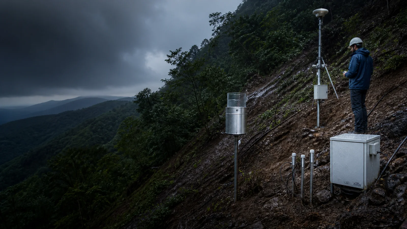
How Landslides Are Monitored
Follow rainfall, soil water and ground movement from hillside instruments to a source-backed assessment without treating every wet slope as an imminent failure.
Explore reported landslidesWhat the data really means
Use these four anchors before interpreting the related live visualization.
- Trigger context
- Rainfall, snowmelt, erosion or seismic shaking
- Hydrologic state
- Soil moisture, suction and pore-water pressure
- Movement
- GNSS, inclinometers, lasers or seismic vibration
- Assessment
- Site-specific evidence, thresholds and uncertainty
From evidence to the PlanetVexa view
Each stage changes what can be claimed. PlanetVexa keeps the source record, derived interpretation and visual presentation visibly distinct.
- 01Trigger context
Rainfall, snowmelt, erosion or seismic shaking
- 02Hydrologic state
Soil moisture, suction and pore-water pressure
- 03Movement
GNSS, inclinometers, lasers or seismic vibration
- 04Assessment
Site-specific evidence, thresholds and uncertainty
A landslide is a process, not one sensor reading
Slope failure occurs when driving forces exceed the strength resisting movement. Material, geometry, groundwater, weathering and previous deformation differ from one hillside to another. Rainfall is a common trigger for shallow failures and debris flows, but the same storm can produce very different responses on neighboring slopes.
A rainfall total, a mapped susceptibility class and an observed landslide are therefore different evidence types. PlanetVexa keeps their source and timestamp separate.
Water inside the slope changes stability
Rain gauges describe incoming water, while buried probes measure volumetric water content, soil suction or pore-water pressure at selected depths. These observations show how quickly water infiltrates and whether subsurface pressure is reducing effective strength. Antecedent wetness can be as important as the latest hourly rain.
The instruments sample a small monitored site. Their readings cannot automatically be transferred to every slope with a similar color on a regional map.
Movement instruments reveal deformation over time
GNSS receivers, extensometers and laser targets can measure displacement; borehole inclinometers detect subsurface tilting; seismic sensors can identify vibration from moving debris. Satellite radar interferometry can map subtle surface deformation across broad areas when viewing geometry and ground coherence permit.
Slow movement can precede acceleration, but some failures begin with little detectable surface motion. Data gaps, damaged sensors and changing site conditions must remain visible.
Thresholds and warnings require local validation
Rainfall thresholds relate intensity and duration to past events, while physical models combine water and slope mechanics. Both have false alarms and missed events. Official warnings integrate current observations, forecasts, terrain and local responsibility rather than relying on a universal trigger value.
PlanetVexa presents official reports and explanatory context. It does not declare a slope safe, predict an individual failure or replace instructions from geological and emergency authorities.
Questions people ask
Does heavy rain mean a landslide will occur?
No. Rainfall is one trigger; slope material, geometry, drainage, antecedent moisture and local thresholds all matter.
Can satellite radar see every landslide moving?
No. Vegetation, snow, viewing geometry, revisit time, rapid failure and loss of surface coherence limit detection.
Is a susceptibility map a current warning?
No. Susceptibility describes where failure is more plausible; a warning also needs current or forecast triggering conditions and responsible-authority assessment.
Read the official material
PlanetVexa summarizes these sources in original language and links to the responsible institutions for definitions and operational context.